Birding in the Thames Estuary on the site of a former Rifle Range: RSPB Rainham Marshes. 20.11.21
- Sim Elliott

- Nov 22, 2021
- 20 min read
I travelled to RSPB Rainham Marshes by train on Saturday 21.11.21, from Brighton to Purfleet; (for full details of how to get to RSPB Rainham Marshes see the end of this post). I had wanted to visit RSPB Rainham Marshes since it opened in 2006. It is an extraordinary and innovative conservation project, located in the mysterious and ecologically-important Thames marshes.
All the photographs in this post are in chronological order. Text in italics are quotations; the citations follow the quotations.
... the world of mists and mudflats out beyond the Thames Barrier and the Royal Docks that once inspired and haunted writers such as Charles Dickens and Joseph Conrad. Yet, despite the estuary’s significance, the 20th century has seen the slow disappearance of 97 per cent of its wetland habitat. As London expanded between 1932 and 1984, marshland was drained, either for industrial development or to create farmland on which to grow arable crops to feed the growing city. As a result, much of the wildlife that once called these places home was pushed back and began to disappear. Restoration projects invite wildlife back to the Thames Estuary - Geographical Magazine
Acquired by the RSPB in 2000, the 352 hectares of grazing marsh and lagoons is a magic kingdom of ecology, serving millions of people in one of the most densely populated and rapidly developing parts of the UK. ... [The] site had been severely polluted by heavy industry and the military. Now it is a site of special scientific interest. [Bill} Oddie, the patron saint of Britain's growing army of naturalists, has been visiting the site for 40 years. Its transformation, he says, is a "dream come true". "There was a period here when the land was actually on fire with methane gas. I remember wandering around with my binoculars - it was enough to bring a tear to your eye," he recalled.
Cleaning up the site has not proved easy. A bomb disposal expert worked for five years to remove unexploded anti-tank mines, millions of live shells, and even radioactive waste.
The area has now been restored and birdwatchers are free to wander new paths along the seawall and between the pools, ditches and reeds.
Wintering wildfowl numbers have soared, with record numbers of wigeon, teal and pintail seen. There are 50 breeding species, including reed buntings, skylarks, meadow pipits, and even peregrine falcons. Wildlife finds a haven on former MoD firing range | The Independent | The Independent
I am fascinating by in-between places; Rainham Marshes is not a fully "natural" wildlife landscape; nor is it part of the dreary urbanisation that has blighted much of the Thames Estuary; although industrialisation and urbanisation surround the site, and remnants of its use as a military facility are still in evidence. It defies simplistic categorisation. Whilst not entirely a "natural" landscape; it is a species-rich landscape. For centuries Rainham Marshes and the Thames Estuary have been fashioned by human intervention, as all inhabited land in the UK has; but the last intervention, the creation of the RSPB reserve, was one undertaken for the benefit of nature
There is a very good argument for establishing nature reserves in urban conurbations, aside from the immediate benefit of the wildlife they conserve. Reserves close to housing, especially when people may not be able to afford to travel long distances, are more likely to engender engagement with ordinary people; not just keen bird aficionados. Increased engagement of people with wildlife, may have many knock-on effects on people's attitudes to nature and may boost pro-environmental behaviours. Experiences in nature are positively associated with stronger pro-environmentalism, such as emotional affinity toward nature Frontiers | Experiences in Nature and Environmental Attitudes and Behaviors: Setting the Ground for Future Research | Psychology (frontiersin.org)
The majority of land in the UK has been effected by human interaction; and landscape-level rewilding across the whole country seems unlikely. Perhaps the best hope for the birds (and other species) that are on the edge of local extinction in the UK is restoration, or the creation, of habitats that support these species wherever possible; hopefully at a scale that (re-)creates landscape-level habitats; not just habitats the size of individual SSSI that don't support self-sustaining communities of species. RSPB Rainham Marshes, and the extension of marshland preservation in the Inner Thames SSSI - see SSSI detail (naturalengland.org.uk) - is a great example or restoring, and enhancing, larger areas of habitat for wetland birds.
This oasis of RSPB Rainham Marshes is situated in an area or suburban dreariness: it is surrounded by post-war characterless social housing; retail estates; industrial estates; a land-fill site; power station and opposite a concrete flood defence (Dartford Creek). It was formerly an MoD Rifle Range; it was probably because it was a government property for defence that these marshes survived the urbanisation that has destroyed most of the Thames's biodiverse marshland. There was little building needed for a Rifle Range; just targets (some of which remain in the reserve in dilapidated state). The rifle range was good for nature; but not for people; if it weren't for the governments perception that troops needed to be trained to shoot people on the marshes, the marshes may have become a retail park, with a ubiquitous superstores and a drive-thru MacDonald's. Aside from the routine and inexorable urbanisation of the Thames Corridor, another threat to the marshes came from the multinational Disney empire. Until the RSPB secured the site for a nature reserve, it was a possible location for the EuroDisney Park (see Wildlife finds a haven on former MoD firing range | The Independent | The Independent). Wigeon, Teal and Pintail are far superior to poorly-paid actors dressed up as Huey, Dewey and Louie.
The reserve is boundaried to the north by the A13, the Eurostar trainline and the train line form Fenchurch Street to Grays; to the south by the Thames and the Veolia land-fill hill and to the west, the industrial sites of Rainham; and to the east Mardyke (a creek flowing into the Thames) and the Centurion Way housing estate.
The A13 drains east London's wound, carrying you up into the sky; before throwing you back among boarded-up shops and squatted terraces. All urban life aspires to this condition; flux, pastiche. A conveyor belt of discontinued industries. A peripatetic museum, horizon to horizon, available to anyone; self-curated. The wild nature graveyard in Newham. Inflatable, corn-yellow chips wobbling in their monster bucket outside McDonald's in Dagenham. River fret over Rainham Marshes".
Ian Sinclair, (2002) 'London Orbital, A Walk Around the M25', quoted by Gerson Nason in Grand tours: The new badlands | The Independent | The Independent 20 October 2002, accessed 21.11.21
RSPB Rainham Marshes is part of a larger Site of Special Scientific Interest (SSSI) the Inner Thames Marshes, see Magic Map Application (defra.gov.uk) and the part which is in the London Borough of Havering has been designated by the council as a Site of Metropolitan Importance for Nature Conservation called Wennington, Aveley and Rainham Marshes.
Travelling to Purfleet
Time is running out for nature. People's awareness of the decline of nature is rising. To travel to Purfleet, I went through London Bridge Station, were the Bee Friendly Trust has erected a sculpture Time is Running Out' by Madeleine Higgs. London Bridge Station see: Time is Running Out for Bees – Bee Friendly Trust

Time to organise for nature. From London Bridge I walked to Liverpool Street to get the Purfleet Train, in Bishopsgate Silent Agitator by Ruth Ewan, is currently located, near Liverpool Street. See: ‘Sculpture in the City’ returns for its tenth year (timeout.com)
Silent Agitator is a large clock based upon a detail of an illustration produced by Ralph Chaplin in 1917 for the Industrial Workers of the World union (the IWW). Chaplin’s illustration, bearing the inscription ‘What time is it? Time to organize!’, was reproduced on millions of gummed stickers, known as ‘silent agitators’, that were distributed by union members in workplaces and public spaces across the US. The clock hands bear workers’ clogs or, in French, sabots from which the word sabotage is derived (sabotage was originally used in English to specifically mean disruption instigated by workers). Clocks are a ubiquitous symbol within industrial disputes as hourly wages and the extent of working hours are often the source of argument. Silent Agitator nods to the IWW’s organising for the rights to a five-day work week and eight-hour work day, and posits a future in which we further reclaim our time. Silent Agitator - Sculpture in the City

My first glimpses of Rainham Marshes Rainham from the train (between Rainham and Purfleet); the train runs parallel with the Eurostar track and the A13


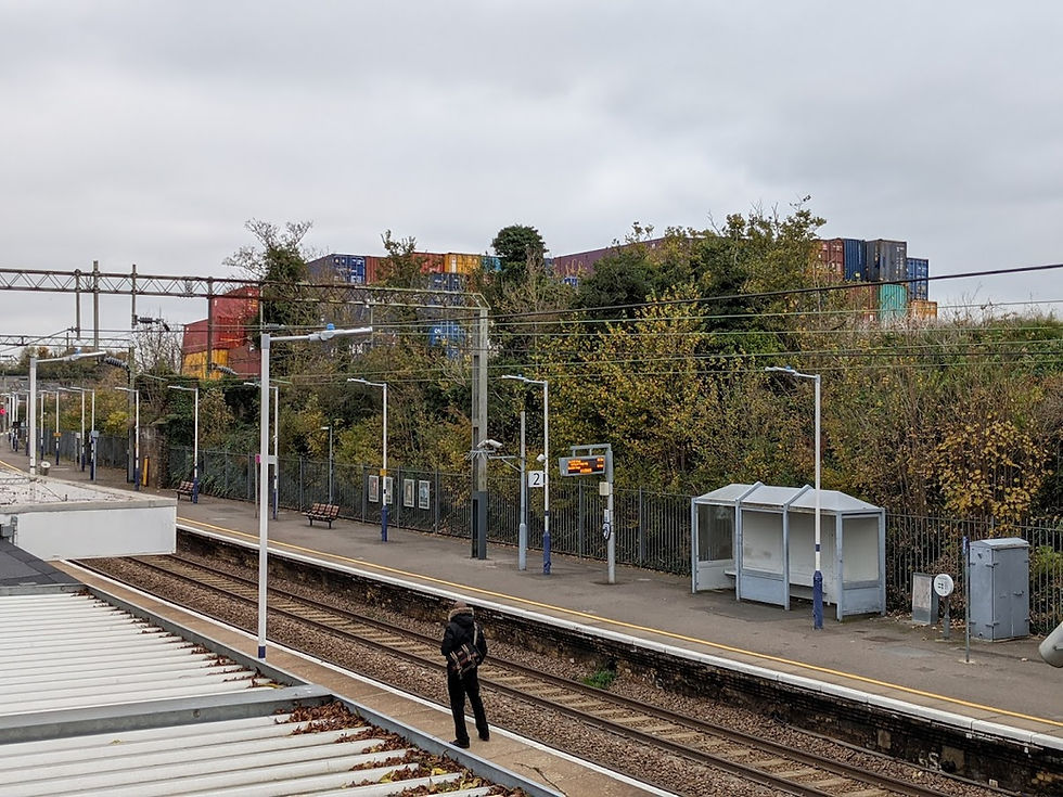
Purfleet Station. The container depot behind Purfleet Station is part of the highly industrialised landscape of the Thames Estuary. The wild beauty of the Thames estuary marshes has largely been replaced by housing and commerce.
The mysterious and obscure nature of the Thames marshes was well-known to some authors. Dickens sets the opening of Great Expectations, where Magwitch first meets Pip, in a graveyard on the Thames marshes (ay Cooling, Kent). Bram Stoker's sets Dracula's first British dwelling-place in Purfleet. The mythic nature of the Thames Estuary, is suggested in the opening of Joseph Conrad's The Heart of Darkness The sea-reach of the Thames stretched before us like the beginning of an interminable waterway. In the offing the sea and the sky were welded together without a joint, and in the luminous space the tanned sails of the barges drifting up with the tide seemed to stand still in red clusters of canvas sharply peaked, with gleams of varnished sprits. A haze rested on the low shores that ran out to sea in vanishing flatness. The air was dark above Gravesend, and farther back still seemed condensed into a mournful gloom, brooding motionless over the biggest, and the greatest, town on earth. Heart of Darkness by Joseph Conrad: Part 1 (online-literature.com)
Despite the destruction of much of the Thames Estuaries former magic; town planners anticipate a brighter future for nature in Purfleet! (Hoarding, London Road Purfleet). See Work starts on £1billion regeneration of Purfleet town centre | Thurrock Gazette

On the way to RSPB Rainham marshes is the site of Purfleet House, which Bram Stoker probably used as a model for Carfax House in Dracula

Purfleet's Thameside green (Purfleet Heritage Centre Park) is on the way to Rainham Marshes. In between the Heritage Park and RSPB Rainham Marshes is West Thurrock Children's Centre, the Heritage Centre (a former Gunpowder Magazine), and an area of 1970s social housing,


From the Heritage Park bizarrely Canary Warf can clearly be seen; the location of much of London's banking and finance sector. Canary Wharf is home to many large international banks; the largest being HSBC, "with an asset base totalling 2.1 trillion pounds and a market capitalization of 131 billion pounds, HSBC is the 7th largest bank in the world. Top 10 Banks in Canary Wharf, London | UK Business Blog (clickdo.co.uk). The Qatar Investment Authority (QIA,) the country's sovereign wealth fund, that has a global portfolio worth about $335bn. And it all comes from gas. Central to its property empire is the Canary Wharf Group (CWG), which it bought with partners Brookfield Property Partners in 2015 for £2.6bn..Qatar: Buying Britain by the pound - BBC News A fifth of all children in Thurrock, the local authority for Purfleet, live in poverty Thurrock Council - Child Poverty Plan 2015-2020.

The Purfleet Magazine building

The Purfleet Heritage & Military Centre is housed within Magazine No.5 of what was once the Royal Magazine for Gunpowder situated on the banks of the River Thames.
Constructed in 1759, the five magazines and Proof House were used to test, store and supply gunpowder to the army and navy, being exceptionally busy during the Napoleonic wars. Each magazine could hold 10,400 barrels of gunpowder which increased to 10,800 barrels in times of emergency. The magazines were protected by Outer and Inner Sanctum Walls with a garrison of soldiers guarding the site. The work within the magazines was undertaken by civilians. The magazines remained in use throughout the 19th and 20th century until 1962, when the land was purchased from the M.O.D by Thurrock Council. Four of the five magazines were demolished in the late 1960s to make way for housing, while No.5 was used as a storage facility by the council. ...
The building is listed as a Scheduled Ancient Monument Grade 1. The Centre houses a wide range of historical artefacts and memorabilia relating to the history of the magazines and local area dating from 18th Century to present day, these include Thames Board Mills, the Purfleet Rifle Range, Van den Burgh and Jurgens margarine factory, the author Bram Stoker (Dracula), brewer Samuel Whitbread and the Royal Family connection are all represented. Purfleet Heritage & Military Centre - Thames Chase Community Forest. For opening times see: Purfleet Heritage (purfleet-heritage.com)

Marshland reeds outside the reserve and Canary Wharf - 14 miles away


The story of the wherries which crossed the Thames from here.

The location of RSPB Rainham Marshes. The green rectangles on the maps above show the RSBP Rainham Marshes estate but only the easterly section is Rainham Marshes reserve itself; the rest is Wennington Marshes, a conservation area with no public access.

source: Google Maps

Source: Google Maps
The village of Wennington, above its marshes: has an extraordinary history which demonstrates that the Thames Marshes have been inhabited for a long time despite their inhospitable nature. First recorded in the tenth century as Winintuna, this was probably the home of a Saxon chief named Wynna. Westminster Abbey held the manor of Wennington from 1066, ...A manor house was in existence by 1198 ... The manor house was called Wennington Hall by 1345 and was probably plundered in the Peasants’ Revolt of 1381. The principal manor became known as Wennington Westminster to distinguish it from neighbouring Wennington Enveyse and was briefly seized by the Crown in the 14th century when its tenant landlord was imprisoned as a rebel.
The area of the manor varied greatly over the centuries but reached a peak in 1664, when it covered 563 acres, which consisted mostly of marshland that had been progressively reclaimed over several centuries. Noke (or Noak) House was built in the 17th century and in 1808 it became the joint workhouse for Rainham, Aveley and West Thurrock. It served this purpose until 1836 and was later converted into five cottages. Wennington Hall, which had become a farmhouse, was rebuilt in the early 1850s and was later modified and refaced with red brick.
Arguably, Wennington’s heyday came during the 60 years following 1868 when the training ship Cornwall was moored at nearby Purfleet and terraced cottages were built here for some of the staff, with a neighbouring laundry. A few council and private houses were built near the square village green in the 1920s, when the population reached a peak of 432.
In 1956 Seven Kings Housing Association built 20 semi-detached houses on the site of Wennington House.... Several of the village’s older buildings were demolished in the second half of the 20th century, but survivors include three groups of cottages – and Wennington Hall Farm, near the junction of Wennington Road and New Road.
The village has around 300 inhabitants, most of whom live in houses scattered along the south side of Wennington Road. To the south lie the barren Wennington Marshes, which now form part of the RSPB’s Rainham Marshes nature reserve. Wennington - Hidden London (hidden-london.com)
The history of the land around Rainham Marshes reserve, goes further back than its use a military range.
The RSPB Rainham Marshes Visitors Centre; opened in 2006

The prestigious 'Regeneration & Renewal' magazine has named RSPB Rainham Marshes nature reserve as the winner of its inaugural ‘Environmentally-Sustainable Regeneration Scheme of the Year’ award. The award recognises work that was carried out between 2005 and 2007 / The RSPB Rainham Marshes Visitor Centre had already won two Royal Institute of British Architects (RIBA) awards this year and is now in the running for the RIBA Sustainability Award. The RSPB: Media: Rainham Marshes wins new award
Looking out over the reserve to the north from the inside of the visitors centre: the A13, the Eurostar trainline; the trainline form Fenchurch Street to Grays; and National Grid Pylons sit behind marshes and grazing cows. On top of one of the bushes in this panorama was a female Marsh Harrier; that could only be seen in a spotting scope.

Map of the reserve from the trail guide: rainham-trail-guide.pdf (rspb.org.uk)

From the visitors centre I walked anti-clockwise around the site.
West Side
Mallards and Teal on the Purfleet Scrape

Looking toward the north perimeter of the reserve

More Mallards and Teal on the Purfleet scrape

Autumn berries; I was hoping to see some Redwings or Fieldfare - our winter migratory thrushes who like berries; but I didn't

The reed beds (form eat side path); landfill site and Rainham industrial sites in the background

A painting of the reed beds by Richard Allan

details:


I didn't see any Stonechats or Marsh Warblers - but I did see plenty of Starlings and Black-Tailed Godwits flying over head in the afternoon (all in this painting).

At the bottom of the east side path is the Woodland Discovery Zone; I focussed on the botanical signs of autumn in the woods


I saw some Long-Tailed Tits in the woods; but as the day was very overcas: the heavy dark skies made photographing birds a challenge


I then turned left as the path meets the northern perimeter of the reserve. Along the northern path the continual hum of electricity form the National Grid power lines is ever-present.

The north path: a boardwalk through the reedbeds
Reeds

Bog Wood


Wild Carrot

Looking from the northerly path (and from everywhere in the reserve) the Dartford Creek Flood Barrier is very visible.
The Dartford Creek Barrier resembles a giant concrete guillotine, bridging the River Darent just before it meets the Thames. The barrier supports two 160-tonne gates which can be dropped to hold back the rising tide. In 2019 it was used about 12 times, whenever water levels threatened to overwhelm the river embankments.
The surrounding marshland and fields lie several metres below the maximum tidal height of the river. The vulnerable floodplain stretches into the nearby towns of Dartford and Crayford (along the River Cray tributary).
Upriver, the much larger Thames Barrier protects central London. On the north bank, the Barking Creek Barrier, a similar (but larger) drop-gate barrier, protects the floodplain of the River Roding.
The Environment Agency usually closes Dartford Creek Barrier when high ‘spring’ tides (which occur roughly once a month) combine with stormy weather. In 2019, the Dartford Creek Barrier closed about 12 times. 2018 saw seven closures and 2017 saw eight. The barrier closed 12 times in 2016 to prevent flooding. The Dartford Creek Barrier (remotelondon.com)
The visitor centre from the north perimeter path

A Goldfinch lit up the darkness of this overcast autumn day

The Ken Barry Hide, a skilfully and artfully remodelled container. Around the hide I heard the characteristic calls of Cetti's Warblers, mixed with the hum of the power lines, but, as usual, didn't see any.

From the Hide - a male Shoveler


A female Shoveler

These ducks may be all the way from Kent! Shovelers are surface feeing ducks with huge spatulate bills. Males have dark green heads, with white breasts and chestnut flanks. Females are mottled brown. In flight birds show patches of light blue and green on their wings. In the UK they breed in southern and eastern England, especially around the Ouse Washes, the Humber and the North Kent Marshes and in much smaller numbers in Scotland and western parts of England. In winter, breeding birds move south, and are replaced by an influx of continental birds from further north. The UK is home to more than 20 per cent of the NW European population, making it an Amber List species. Shoveler Duck Facts | Anas Clypeata - The RSPB


A Coot

Teal

Teals are small dabbling ducks. Males have chestnut coloured heads with broad green eye-patches, a spotted chest, grey flanks and a black edged yellow tail. Females are mottled brown. Both show bright green wing patches (speculum) in flight. They are thinly distributed as a breeding species with a preference for northern moors and mires.
In winter, birds congregate in low-lying wetlands in the south and west of the UK. Of these, many are continental birds from around the Baltic and Siberia. At this time, the UK is home to a significant percentage of the NW European wintering population making it an Amber List species. Teal Duck Facts | Anas Crecca - The RSPB


Maps and painting inside the hide (artist not stated)


The boardwalk through the reed beds on the north of the reserve

From the viewing platform, looking out over Aveley Pools, on the northern boardwalk; a Pied Wagtail

More Shovelers!


Looking toward the Visitors Centre from the viewing platform.

Lichen on the viewing platform


Averley Pools (Averely Marsh)

A juvenile Mute Swan stretching its wings


Teal

Reeds

I looked for a Peregrine on the pylon; but I could not find amy!


West path: Wennington Marshes and the Target Pools to the the west and Rainham Marshes and Butts Scrape to the east
As the path turns 90 degrees south, on the right (west) are the Target Pools. There were many Lapwings there; in the background are cattle conservation grazing the adjacent Wennington Mashes; part of the Inner Thames SSSI, managed by the RSPB, but not open to visitors; and the hill of the Veolia landfill site; made of London's rubbish.

Lapwings and wind turbine - and the landfill hill. The gas produced by the rubbish is drawn off and used to generate electricity EDL owns and operates the Rainham Landfill Gas Power Station located in Essex near the town of Dagenham, in the UK, with a capacity of 17.8MW. Rainham Landfill Gas Power Station | Projects | EDL (edlenergy.com)
Rainham Landfill site: Coldharbour Lane, Rainham, Essex ; Permitted tonnages: 1,500,000 tonnes per annum; Site scope: 70,000 tonnes per annum Materials Recovery Facility, 70,000 tonnes per annum Green Waste, Soil Washing, Leachate Treatment Plant. Electricity generation. Installed landfill gas capacity of 16.7MWe) Our Landfill Sites | Veolia UK
The landfill site has been extended; and the planning application of 2012 acknowledged that that would have a detrimental impact on RSPB Rainham Marshes. Although extending the life of the landfill and recycling operation will not increase the quantum of existing negative impacts on the adjacent nature reserve – including the predation of eggs and chicks of ground-nesting birds by foxes, gulls and crows attracted to the landfill - the extension of the life of the landfill will prolong these adverse impacts. Predation of eggs and chicks, in particular, is an existing significantly adverse impact as it limits the ability of the site to conserve ground-nesting birds, such as lapwing and redshank which are of high and medium national conservation priority respectively. Microsoft Word - rainham_landfill_site_report.rtf (london.gov.uk)

Shooting Butts Hide (west side path)


Views of Butts' Scrape from the Shooting Butts Hide: lots of Lapwings

Also known as the peewit in imitation of its display calls, its proper name describes its wavering flight. Its black and white appearance and round-winged shape in flight make it distinctive, even without its splendid crest. This familiar farmland bird has suffered significant declines recently and is now a Red List species. Lapwing Bird Facts | Vanellus Vanellus - The RSPB

The UK population of the lapwing fell by at least 40 per cent between 1970 and 1998*. This decline has been largely caused by the loss of mixed farming and spring cropping, and the intensification of grassland management. Declines in the west of the UK are leading to local extinctions.*Data source: British Trust for Ornithology Lapwing Conservation | Advice For Farmers - The RSPB
Lapwings and Shovelers

Teal

Greylag Geese and Coots and a Lapwing

Lapwings (and a Greylag Goose)

A Greylag Goose and Lapwing

The ancestor of most domestic geese, the greylag is the largest and bulkiest of the wild geese native to the UK and Europe. In many parts of the UK it has been re-established by releasing birds in suitable areas, but the resulting flocks (often mixed with Canada geese) found around gravel pits, lakes and reservoirs all year round in southern Britain tend to be semi-tame and uninspiring. The native birds and wintering flocks found in Scotland retain the special appeal of truly wild geese. Greylag geese are listed in Schedule 2 of the Wildlife and Countryside Act, meaning they can be killed or taken outside of the close season. Greylag Goose Facts | Anser Anser - The RSPB
A Teal shows a Lapwing its wings; the Lapwing shows little interest!

Shovelers and Lapwings

Canada Geese and Lapwings, Shovelers and Teal

Lapwings and a Coot

Snipe! The bird that goes out of its way not to be seen. There are three Snipe here, on the bank behind the teal.

Snipe are medium sized, skulking wading birds with short legs and long straight bills. Both sexes are mottled brown above, with paler buff stripes on the back, dark streaks on the chest and pale under parts. They are widespread as a breeding species in the UK, with particularly high densities on northern uplands but lower numbers in southern lowlands (especially south west England). In winter, birds from northern Europe join resident birds. Snipe Bird Facts | Gallinago Gallinago - The RSPB

Their range in the UK declined by 19 per cent between 1970 and 1990*. The main reason for the decline on farmland has been the drainage of grassland and moorland. *Data source: British Trust for Ornithology
Key points [for conservation]
- Retain and restore patches of wet ground in both grassland and moorland areas.
- Extensively graze wet grasslands to provide a mosaic of tall and short vegetation.
- Minimise grazing during the nesting period.

A Little Grebe (Dabchick)

Looking over the Target Pools

Various gulls (Great Black-Backed Gulls; Black-Headed Gulls) and some Coots, on the Target Pools

Shovelers again.

Looking over from the west path to the Centurion Road housing estate at the eastern perimeter of the reserve (beyond Mardyke)

Grey Herons on the Target Pools

Looking South - Canada Geese and the Dartford Creek Flood Barrier

Lapwings and the wind turbines of Rainham

More Grey Herons in the Target Pools


The Lapwings were spooked by something, possibly a Marsh Harrier or a Peregrine, and flew up, circled around and came back down


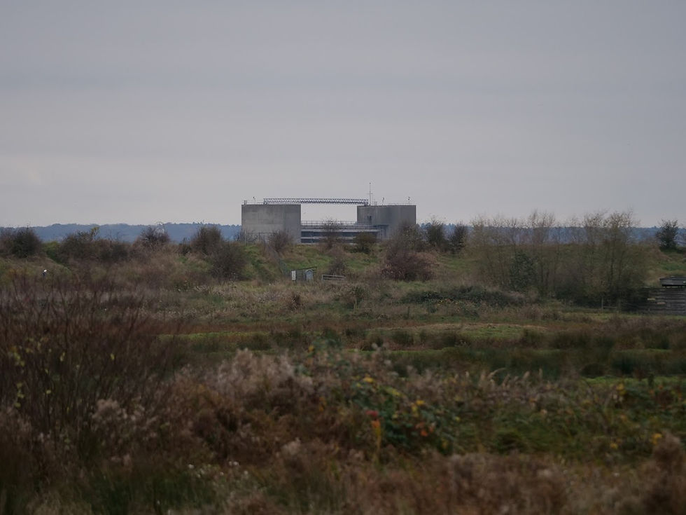
The power station behind the Target Pool

The Ministry of War/MOD Riffle Ranges
Here is the old sign of the Purfleet Riflerange Halt railway station

Purfleet Rifle Range was created by the war department in 1906 on the Rainham and Wennington Marshes. An untimetabled halt named Purfleet Rifle Range opened in 1911 to serve the range. It was located on the west side of Tank Hill Road level crossing. This station layout was dictated by the access point into the rifle range, including a standard gauge spur and the location of the level crossing which required the platforms to be staggered. The up platform was located between the crossing and the spur and the down platform was substantially staggered to the north. The up side was an island with a bay platform. A wide footbridge spanned the station at the north end of the up platform. It had three stairways, one to each platform with the third giving access to the rifle range. A building stood at the bottom of these steps. Disused Stations: Purfleet Rifle Range Station (disused-stations.org.uk)
For more details on the Firing Ranges archaeological remains; see: Rainham Marshes Firing Range | Beyond the Point - Classic Blog (wordpress.com)
The MoD missed some ordinance when it cleared up the site: Birdwatchers – and a field of cows – had to be evacuated from Rainham Marshes when an unexploded bomb was spotted during landscaping work yesterday. (7/11/13) Feathers ruffled as MoD bomb found at RSPB Rainham Marshes | Romford Recorder
A site-specific art installation depicting the life of the Riffle Butts


The Mantlet


A Black-Headed Gull flying over the Mantlet

Reeds

The Riffle Butts

The Department for War rifle range were opened in 1906. My paternal grandfather was in the riffle brigade and served on the Western Front and then in 1916 was forced to go to Dublin in the Easter Rising - he would never say whether he signed up or was conscripted, I think the latter. He never talked much about WWI or the Easter Rising, but he could have done some of his training here.

On Aveley Marsh three Stop Butts were created (part of one still stands) with a Mantlet bank in front of each. This broken linear feature still divides Aveley and Wennington Marshes. The hundred yard shooting ridges can still be seen across the marsh and in the scrub the Cordite store and one of eight anti-aircraft ammunition magazines still stands testament to the military history of the marshes. It was an important air defence location during both wars and a Zeppelin was reputed to have been shot down from the Anti-submarine blockhouse in March 1916 while decoy beacon fires were lit on Wennington during WWII air raids. Rainham Marshes Firing Range | Derelict Places - Urban Exploring Forum

A Little Egret and Shoveler ducks close to the Rifle Butts

and Greylag Geese

South Path - MarshLand
The RSPB has devoted an area of the site to children's education on the ecology of marshland.

Inside there is great educative art work.

Rainham Marsh has the highest density of Water Voles in the UK. The London Water Vole Project - begun in 2001, this project has become the focus for the conservation of water voles in London and other key areas. Surveys are continuously carried out on Rainham Marshes Nature Reserve, to ascertain and monitor the resident water vole population. BBC - Essex Nature - Rainham Marshes


Child-level observation windows in a child-centre bird hide.

The MarshLand children's area is constructed from containers

Geese on Purfleet Scrape

The Victors Centre from the south path at dusk

A Kestrel over the Purfleet Scrape


A raised observation platform made to view the Purfleet Scrape above the reeds which obscure the view at ground level.

Magpies at dusk.

Reeds around the Purfleet Scrape

Views from the big chair raised platform. More Shovelers

The Visitors Centre through the reeds around the Purfleet Scrape

The Purfleet Scrape; ducks, ducks, ducks!

A Little Egret

Views from the Thames Bank Path outside the reserve at dusk.
Looking back to the reserve: Cows and Geese.

The wind turbine at Erith (Kent)

The Dartford Creek Flood Barrier with many Gulls in front


Erith (Kent)

A Great Black Backed Gull and it's minions - Back Headed Gulls!

Gulls on the mud beach below the landfill hill.


The Landfill Hill


On the north bank of the Thames

A Curlew on the north bank

A Redshank oppose Erith

Another Curlew on the mud beach of the north shore of the Thames


A Little Egret flying from the direction of the Queen Elizabeth Bridge.

Three Redshanks and many Black-Headed Gulls on the mud beach of the north shore.

Looking back on the Rifle Butts from the Thames path

Common Mullein still in flower on the Thames path, opposite Erith; one of the few UK wild plants the continues to flower in winter.

The Queen Elizabeth Bridge at Dartford.

Autumn leaves against the concrete of the Thames Path wall

Dartford at dusk.

The towers of the Queen Elizabeth Bridge, behind the Centurion Road estate

The Visitors Centre at night.

Mardyke entering the Thames. The words Mar Dyke means boundary ditch and beginning in the Brentwood Hills, the Mardyke River flows across the fens at Bulphan and Orsett, entering the River Thames at Purfleet. Overview | Mardyke Valley | Thurrock Council

A Million Years in Purfleet - a public art work (the RSPB visitors centre can be seen through the circle).

Train travel details:
From Brighton, at the weekend, take a train to London Bridge or Farringdon. I walked to Liverpool Street (to avoid using the underground) and caught a train to Purfleet (which is nearer to the entrance of RSPB Rainham Marshes than Rainham station). You could carry carry on on the Brighton train to Farringdon and get the tube to Liverpool Street from there.
On weekdays the trains to Purfleet commence at Fenchurch Street not Liverpool Street; you could walk from London Bridge to Fenchurch Street or go on to Blackfriars, and get the tube to Fenchurch Street.
From Purfleet station turn left (west) after leaving the station and walk along the London Road. When the road reaches the green on the Thames; follow the Thames riverside path (west) to the entrance of RSPB Rainham Marshes


Comments